Leica Geosystems/AHAB
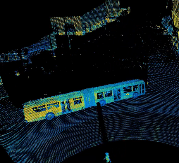
Eclipse designed, sourced, and aligned the optical system for Leica Geosystems’ airborne bathymetric sensor. Airborne Hydrography AB (AHAB), now part of Leica Geosystems, develops airborne LiDAR survey systems for bathymetric and topographic surveys. Leica Geosystems is a long-term partner to Eclipse.
Technology: Airborne bathymetric sensor optical system
Challenge: Design, source, and align an optical system that fits within the strict volume and weight constraints of an airborne survey platform.
Our contribution: Optical design, project management, test and alignment.
Read more about Leica Geosystems Hawkeye bathymetric sensors
Category:
Date:
5 April 2023